Arizona
The Grand Canyon State
Arizona became the 48th state on February 14, 1912, the last of the contiguous states to join. Its capital, Phoenix, is also its largest city and the most populous state capital in the country. Arizona's official nickname, adopted in 2011, is the Grand Canyon State.
- Capital
- PhoenixCapital since 1889
- Statehood
- February 14, 191248th state
- Population, 2025
- 7,623,81814th of 50
- Area
- 113,990 sq mi6th largest · 295,234 km²
- Largest city
- Phoenix1,665,481 people
- Abbreviation
- AZUS Postal Service code
- Motto
- Ditat Deus“God enriches”
- Borders
- 4 statesMexico
The last of the 48
Arizona waited a long time for statehood. Its territorial voters approved a state constitution as early as 1891, but Congress did not act. In 1906 Congress offered statehood on the condition that Arizona join with New Mexico as one big state, and Arizona voters rejected it by 16,265 votes to 3,141.
Congress finally passed an Enabling Act in 1910, and Arizona wrote a progressive constitution that let voters recall elected officials, including judges. President William Howard Taft vetoed the statehood resolution in 1911 because of the judicial recall. Arizona took the provision out, was admitted on February 14, 1912, and that November its voters put the recall of judges back into the constitution. Arizona was the last of the 48 contiguous states to join; Alaska and Hawaii followed in 1959.
Where the name comes from
Historians still argue about the name. Spanish records mention a place called Arizona in the Pimería Alta, the region that spans today’s southern Arizona and northern Sonora. An older theory traces the word to an O’odham place name meaning “place of the little spring.” Another, argued by historian Donald T. Garate and supported by Arizona’s state historian, traces it to Basque: aritz ona, “the good oak tree,” the name of a ranch founded in Sonora in the 1730s by a man of Basque descent, which became famous after a large silver strike nearby.
A capital on wheels
Arizona’s territorial capital moved four times in 26 years. It started at Fort Whipple in 1863, moved to the new town of Prescott in 1864, went south to Tucson in 1867 in a vote that Prescott’s newspaper claimed was bought, and returned to Prescott in 1877. In 1889 the legislature settled the rivalry by choosing Phoenix, a growing farm town in the irrigated Salt River Valley between the two. The capital page tells the story.
The Grand Canyon State
Arizona’s best-known landmark gave the state its nickname. “The Grand Canyon State” was used informally for decades before the legislature made it official in 2011, just ahead of the statehood centennial. The motto, Ditat Deus, Latin for “God enriches,” dates back to the territorial seal of the 1860s and was written into the state constitution in 1912.
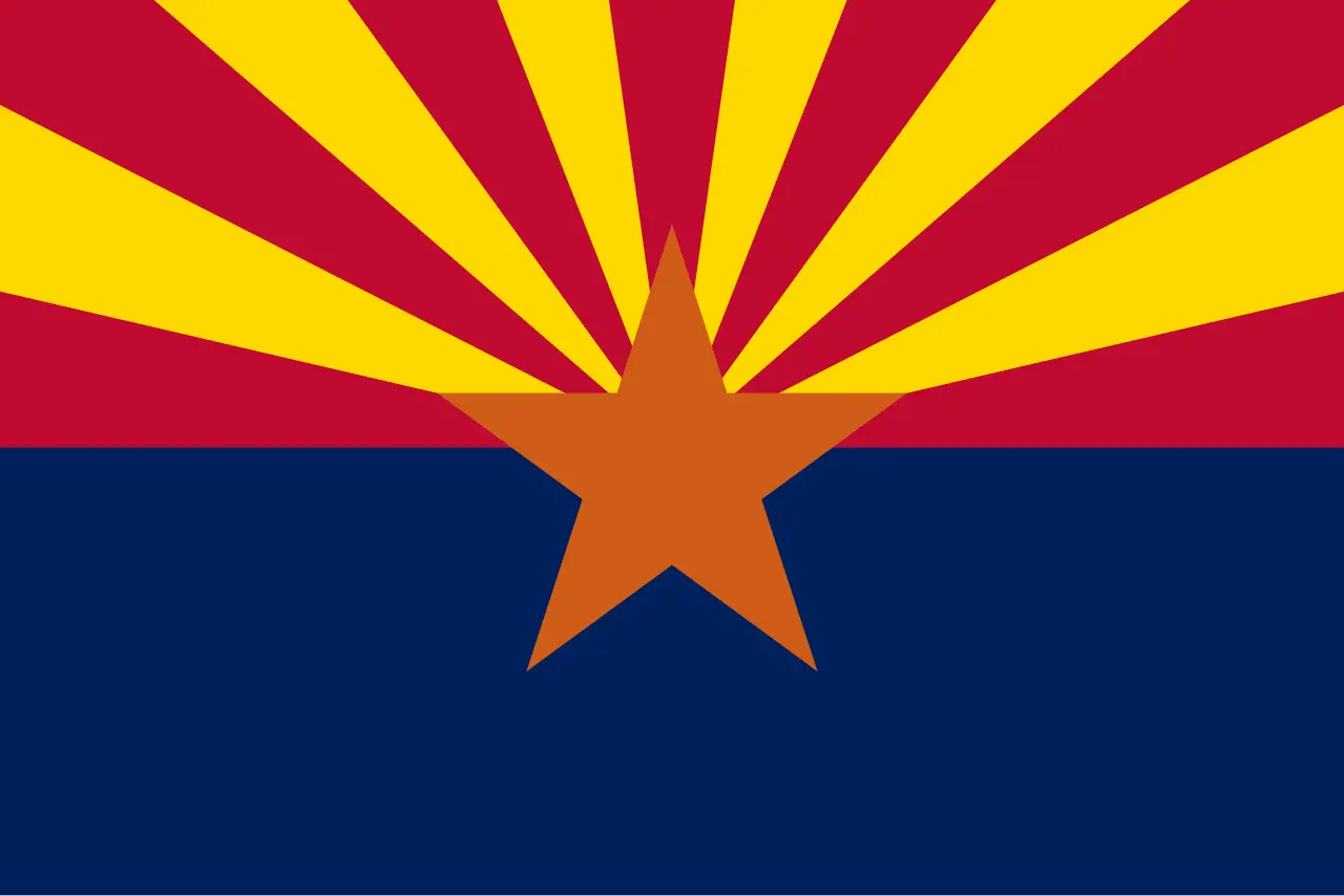
Early Arizona promoted itself with the “Five C’s”: copper, cattle, cotton, citrus and climate. Copper is still the state’s emblem. The star at the center of the flag is copper-colored, and in 2015 copper became the official state metal, after a fourth-grade civics class at Copper Creek Elementary School suggested it.
The climate is the other half of the story. Arizona’s hottest recorded temperature is 128°F, measured at Lake Havasu City on June 29, 1994. Perhaps for that reason, most of the state does not bother with daylight saving time.
Unusual symbols
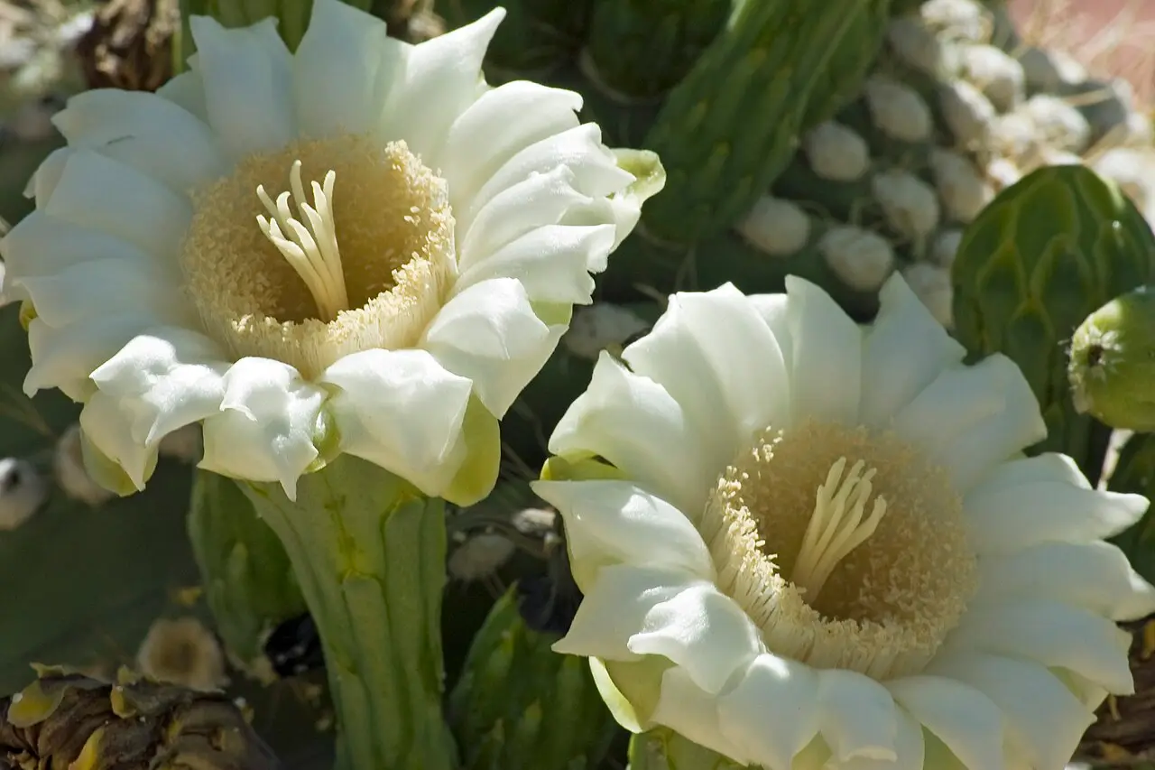
Arizona has 25 official symbols, and some are unlike any other state’s. Its state planet is Pluto, discovered in 1930 at Lowell Observatory in Flagstaff and adopted in 2024. Its state neckwear is the bola tie, its official firearm the Colt Single Action Army revolver, and its official drink lemonade. The state bird is the cactus wren, and the state flower is the saguaro blossom, the white flower of the giant cactus that has become the symbol of the Southwest. See every symbol on the Arizona symbols page.
Land and people
Arizona covers 113,990 square miles, the sixth largest state, and had about 7.62 million residents in 2025, 14th in the country and one of the fastest-growing states of recent decades. It borders California, Nevada, Utah and New Mexico, touches Colorado at the Four Corners, and shares a long border with Mexico. Phoenix, with about 1.67 million people, is the largest city, followed by Tucson, Mesa, Gilbert and Chandler, most of them part of the Phoenix metropolitan area.
Arizona state symbols
All 25 official symbols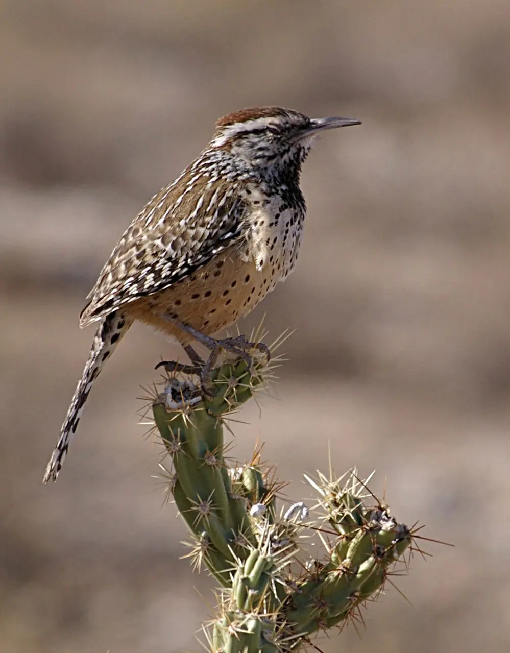

The capital: Phoenix
The capital of Arizona is Phoenix, the seat of government since 1889. Before that the territorial capital moved four times, between Fort Whipple, Prescott and Tucson, earning the nickname "the capital on wheels." Phoenix is also Arizona's largest city and, with about 1.67 million residents, the most populous state capital in the United States.
- 1889–todayPhoenix
Where Arizona is
Arizona shares a border with 4 states: California, New Mexico, Nevada and Utah. It also borders Mexico.
- Land area
- 113,594 sq mi
- Water area
- 396 sq mi
- Population density
- 67.1 people per sq mi (32nd)
Arizona trivia
- In 1906 Arizona voters rejected joint statehood with New Mexico by 16,265 votes to 3,141.Source: Arizona State Library, Archives and Public Records
- Arizona's hottest recorded temperature is 128 degrees Fahrenheit, at Lake Havasu City on June 29, 1994.Source: Arizona State Library, Archives and Public Records
- Most of Arizona does not observe daylight saving time and stays on Mountain Standard Time all year.Source: Arizona Capitol Museum
- Arizona has an official hummingbird capital: a 2021 law gave the title to Sierra Vista.Source: Arizona State Legislature
Questions about Arizona
- What is the capital of Arizona?
- Phoenix, the capital since 1889, when Arizona was still a territory. It is also the largest city in Arizona and the most populous state capital in the United States.
- When did Arizona become a state?
- On February 14, 1912, as the 48th state. It was the last of the 48 contiguous states to be admitted.
- What is Arizona's nickname?
- The Grand Canyon State, which became the official nickname by law in 2011, shortly before the state's centennial.
- What are the Five C's of Arizona?
- Copper, cattle, cotton, citrus and climate, the five pillars of Arizona's economy in its early decades.
- Does Arizona observe daylight saving time?
- Most of Arizona does not. It stays on Mountain Standard Time all year, although the Navajo Nation in the northeast does change its clocks.
Photo credits (5)
- Flag of Arizona: Original: Unknown author Vector: Madden, Public domain, via Wikimedia Commons
- Cactus wren: Mark Wagner, CC BY 2.5, via Wikimedia Commons
- Saguaro blossom: Ken Bosma, CC BY 2.0, via Wikimedia Commons
- Palo verde: Forest & Kim Starr, CC BY 3.0, via Wikimedia Commons
- Ringtail: Unknown author, Public domain, via Wikimedia Commons
Sources
- Arizona Almanac: Chronological Timeline of Arizona Arizona State Library, Archives and Public Records (Arizona Secretary of State) · statehood
- Arizona Almanac: Arizona's Capital Arizona State Library, Archives and Public Records · capital
- The Meaning of Arizona Arizona State Library, Archives and Public Records
- "Made of Sterner Stuff: Honoring Arizona's History as a Bastion of Democracy" Arizona State Law Journal
- A.R.S. § 41-860.01 (state nickname) Arizona State Legislature
- Arizona's Five C's Arizona State Library, Archives and Public Records
- US Census Bureau Vintage 2025 population estimates; 2010 state area measurements