Maine
The Pine Tree State
Maine became the 23rd state on March 15, 1820, when it separated from Massachusetts as part of the Missouri Compromise. Its capital is Augusta, one of the smallest state capitals, and its largest city is Portland. Maine is the Pine Tree State, the only state that borders just one other state, and the only one with a one-syllable name.
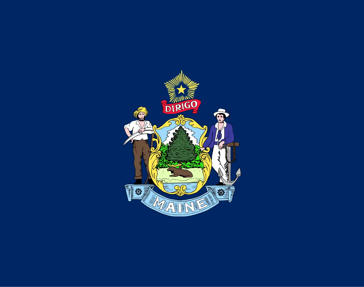
- Capital
- AugustaCapital since 1832
- Statehood
- March 15, 182023rd state
- Population, 2025
- 1,414,87442nd of 50
- Area
- 35,380 sq mi39th largest · 91,633 km²
- Largest city
- Portland69,911 people
- Abbreviation
- MEUS Postal Service code
- Motto
- Dirigo“I direct (or I lead / I guide)”
- Borders
- 1 statesCanada · Ocean coast
Out of Massachusetts
For more than 150 years Maine was part of Massachusetts, governed from Boston as the “District of Maine.” By the early 1800s many people in Maine wanted their own state, and after years of debate, Maine’s voters approved separation. Congress tied Maine’s admission to the fight over slavery: under the Missouri Compromise of 1820, Maine entered the Union as a free state, balancing Missouri, which came in as a slave state. Maine became the 23rd state on March 15, 1820.
A name nobody can explain
Maine is the only state with a one-syllable name, and nobody knows for certain where it came from. The name, sometimes spelled “Mayne,” was on record by 1622. The leading theories trace it to the former French province of Maine, or to a sailors’ term for the “main” land, as distinct from the many islands along the coast. An old story that it honored Queen Henrietta Maria has been debunked. A 2001 legislative resolution named the French province as the source, but historians have not settled the question.
The Pine Tree State
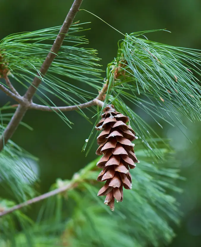
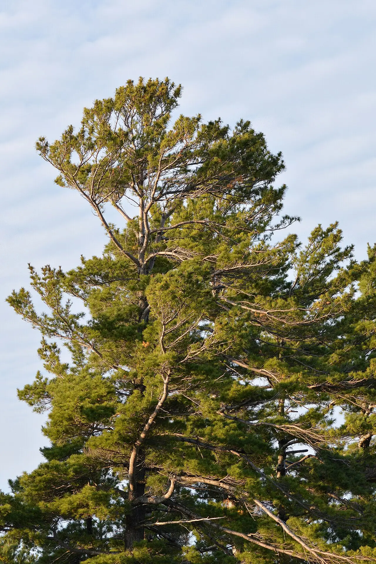
The eastern white pine shaped Maine’s history. In 1605 Captain George Weymouth took samples back to England. In 1691 England’s “Broad Arrow” policy reserved the biggest pines near water as masts for the Royal Navy, and Maine timber built ships and towns for centuries. Most of the accessible old-growth pine was cut by 1850, but Maine’s lumber output peaked as late as 1909. The pine is on the state seal and flag, its cone and tassel became the state “floral emblem” in 1895, and the white pine itself became the state tree in 1945. “The Pine Tree State” is a traditional nickname, not a legal one.
The state motto, Dirigo, Latin for “I lead” or “I direct,” has been on the seal since 1820, beneath the North Star.
Augusta
After statehood, Portland served as the temporary capital while towns competed for the permanent one. In 1827 the legislature chose Augusta, on the Kennebec River, for its more central location, and in 1832 lawmakers moved into a granite State House designed by Charles Bulfinch, the architect of the Massachusetts State House. With about 19,000 residents in 2025, Augusta is one of the smallest state capitals. The capital page tells the story.
Lobsters, moose and whoopie pies
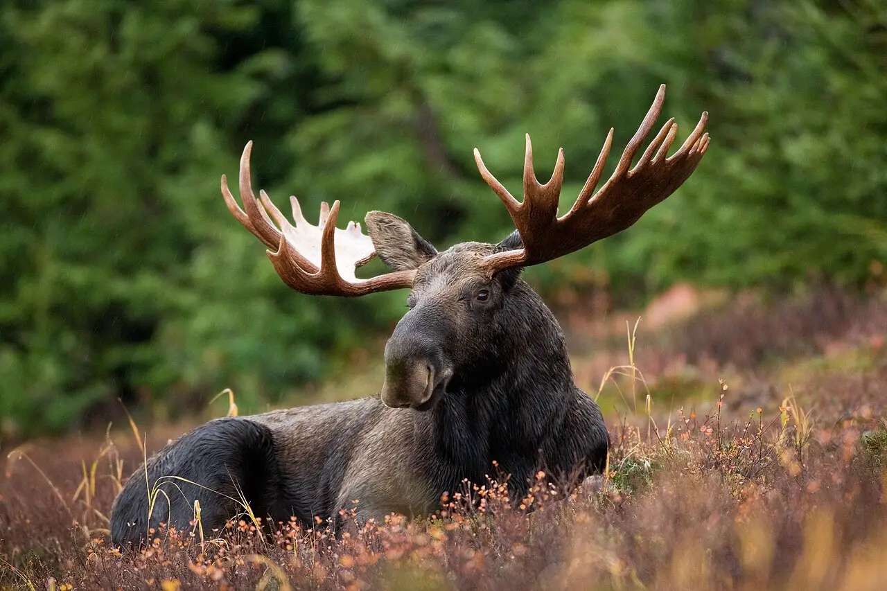
Maine has 35 official symbols, many of them from its woods and waters. The moose is the state animal: Maine has the largest moose population in the lower 48 states, estimated at 60,000 to 70,000. The black-capped chickadee is the state bird, the Maine coon the state cat, the Maine lobster the state crustacean and the landlocked salmon the state fish. Tourmaline, found in Maine’s pegmatite rock, is the state mineral. The food list is famous too: the wild blueberry is the state berry, blueberry pie the state dessert, the whoopie pie the state treat and Moxie, a bittersweet soda invented by a Maine native in 1884, the state soft drink. See every symbol on the Maine symbols page.
The flag shows the state coat of arms, a farmer and a sailor beside a pine and a moose, on blue. In 2024 voters rejected a proposal to return to an older pine tree flag.
Land and people
Maine covers 35,380 square miles, almost as much as the rest of New England combined, and is 39th in area among the states. It had about 1.41 million residents in 2025, 42nd in the country. It borders only New Hampshire among the states, the only state to border just one other, and shares a long border with the Canadian provinces of Quebec and New Brunswick. Its deeply indented Atlantic coast has more than 3,400 miles of shoreline. Portland, with about 70,000 people, is the largest city, followed by Lewiston and Bangor.
Maine state symbols
All 35 official symbols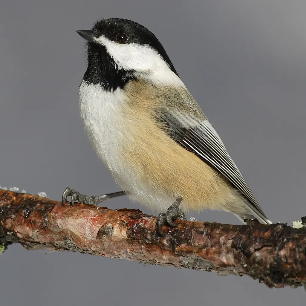
The capital: Augusta
The capital of Maine is Augusta, on the Kennebec River, the seat of government since 1832. Portland served as a temporary capital for Maine's first twelve years, while seven towns competed for the permanent title. Augusta's granite State House was designed by Charles Bulfinch, and its original drawings are the only complete set to survive for any of his buildings.
- 1820–1832Portland
- 1832–todayAugusta
Where Maine is
Maine shares a border with 1 state: New Hampshire. It also borders Canada.
- Land area
- 30,843 sq mi
- Water area
- 4,537 sq mi
- Population density
- 45.9 people per sq mi (38th)
Maine trivia
- The original architectural drawings of the Maine State House are the only complete set to survive for any Charles Bulfinch building.Source: Maine Secretary of State
- Maine's state law says that naming something a state symbol gives it no extra protection under environmental or other laws.Source: Maine Legislature, Office of the Revisor of Statutes
- Maine has three official songs: a state song (1937), a state ballad (2019) and a state song of the 21st century (2021), plus an official march.Source: Maine Secretary of State (Kids' Page)
- The state fossil, Pertica quadrifaria, was one of the largest land plants of its time, about 390 million years ago.Source: Maine Secretary of State (Kids' Page)
- The schooner Bowdoin, Maine's state vessel, was sold to the U.S. Navy in 1941 and helped set up airfields in Greenland during World War II.Source: Bowdoin College, Peary-MacMillan Arctic Museum
- Moxie, the state soft drink, dates to 1884 and is celebrated each July at the Moxie Festival in Lisbon Falls.Source: Maine Secretary of State (Kids' Page)
Questions about Maine
- What is the capital of Maine?
- Augusta. The legislature chose it in 1827, and lawmakers first met in the new State House there in 1832. Portland was the temporary capital before that.
- Why is Maine called the Pine Tree State?
- For the eastern white pine, whose timber shaped Maine's economy for centuries. The pine appears on the state seal and flag and is the state tree. The nickname is traditional and not set in law.
- What does Dirigo mean?
- Dirigo is Latin for "I direct" or "I lead." It has been Maine's motto since 1820.
- Was Maine part of Massachusetts?
- Yes. Maine was a district of Massachusetts until 1820, when it separated and became a state under the Missouri Compromise, which paired it, as a free state, with Missouri as a slave state.
Photo credits (5)
- Flag of Maine: Unknown author, Public domain, via Wikimedia Commons
- Black-capped chickadee: Mdf, CC BY-SA 3.0, via Wikimedia Commons
- White pine cone and tassel: sciondriver at Flickr, CC BY 2.0, via Wikimedia Commons
- Eastern white pine: Ryan Hodnett, CC BY-SA 4.0, via Wikimedia Commons
- Moose: Ryan Hagerty, Public domain, via Wikimedia Commons
Sources
- History of Maine (5): Statehood Maine Legislature · statehood
- The State House Maine Legislature · capital
- Maine State House (Maine Atlas) Maine Secretary of State · capital
- "Maine: the only state with a one-syllable name" Maine Secretary of State
- Maine Revised Statutes, Title 1, §205 (state motto) Maine Legislature
- Eastern White Pine Maine Forest Service
- Shoreline Mileage of the United States NOAA Office for Coastal Management
- US Census Bureau Vintage 2025 population estimates; 2010 state area measurements