Alaska
The Last Frontier
Alaska is the largest state by far, more than twice the size of Texas, and the least densely populated. It became the 49th state on January 3, 1959. Its capital is Juneau, a city that cannot be reached by road, and its largest city is Anchorage.
- Capital
- JuneauCapital since 1906
- Statehood
- January 3, 195949th state
- Population, 2025
- 737,27048th of 50
- Area
- 665,384 sq mi1st largest · 1,723,337 km²
- Largest city
- Anchorage287,155 people
- Abbreviation
- AKUS Postal Service code
- Motto
- North to the FutureEnglish
- Borders
- No statesCanada · Ocean coast
The biggest state, and the emptiest
Alaska covers 665,384 square miles, more than a sixth of the whole United States and two and a half times the size of Texas. Its shoreline, measured by NOAA around every bay and island, runs 33,904 miles, more than a third of the national total. Yet only about 737,000 people lived there in 2025, which makes Alaska 48th in population and last in density, with roughly one person for every square mile of land.
Most Alaskans live in a small part of the state. Anchorage alone is home to almost 290,000 people, nearly two in five Alaskans. Juneau and Fairbanks, with about 31,000 people each, are a distant second and third.
From Russian America to the 49th state
For most of the 1800s Alaska was a Russian colony, run by a fur-trading company from New Archangel, today’s Sitka. The United States bought it in 1867, and the transfer ceremony took place in Sitka that October. For decades afterward Alaska was governed loosely, first as a military district and then as the District of Alaska, and it became a territory only in 1912.
The push for statehood grew after World War II, which brought military bases, new roads and thousands of new residents to Alaska. Congress passed the Alaska Statehood Act, which President Eisenhower signed on July 7, 1958. Alaskans voted to accept its terms, and on January 3, 1959, Eisenhower’s proclamation made Alaska the 49th state. A new 49-star flag was unfurled that same day.
The name
The name comes from the Unangan, or Aleut, people of the Aleutian Islands. Their word for the Alaska Peninsula, Alaxsxa, means “the mainland,” as opposed to the islands. Russian traders adopted it as “Alyaska,” and over time the name spread from the peninsula to the whole territory. The often-repeated translation “the Great Land” is, according to the City of Unalaska, a mistake.
A capital you cannot drive to
Juneau has been the capital since 1906, when the government’s records were shipped there from Sitka on a mail boat. It sits on the mainland in Southeast Alaska, hemmed in by mountains and icefields, and no road connects it to the rest of North America: people arrive by plane or by ferry. Alaskans voted in 1974 to move the capital to a site on the road system, but the move was never paid for, and later attempts failed. The capital page tells the full story.
A flag designed by a 13-year-old
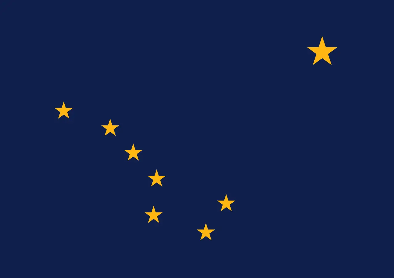
Alaska’s flag was designed by a child. In 1927 Benny Benson, a 13-year-old seventh grader at a mission school near Seward, won a territory-wide contest with eight gold stars on a blue field: the Big Dipper, pointing to the North Star. The legislature adopted it that year, and the law still names him as its designer. The flag page has the story.
Alaska has no official nickname. “The Last Frontier,” the most common, comes from the closing line of the state song, which calls the flag “the simple flag of a last frontier.” The official motto, adopted in 1967, is “North to the Future.”
Symbols of the north
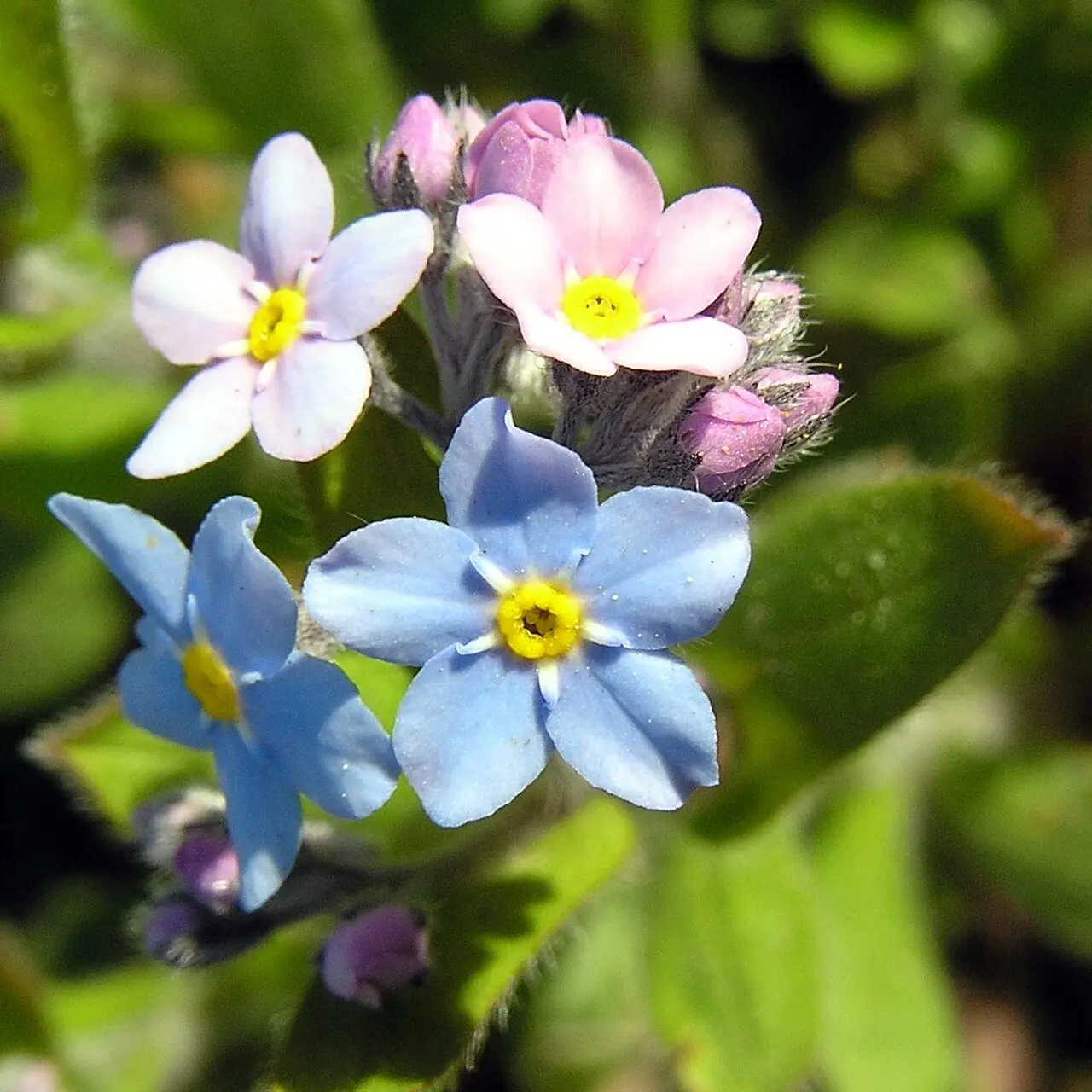
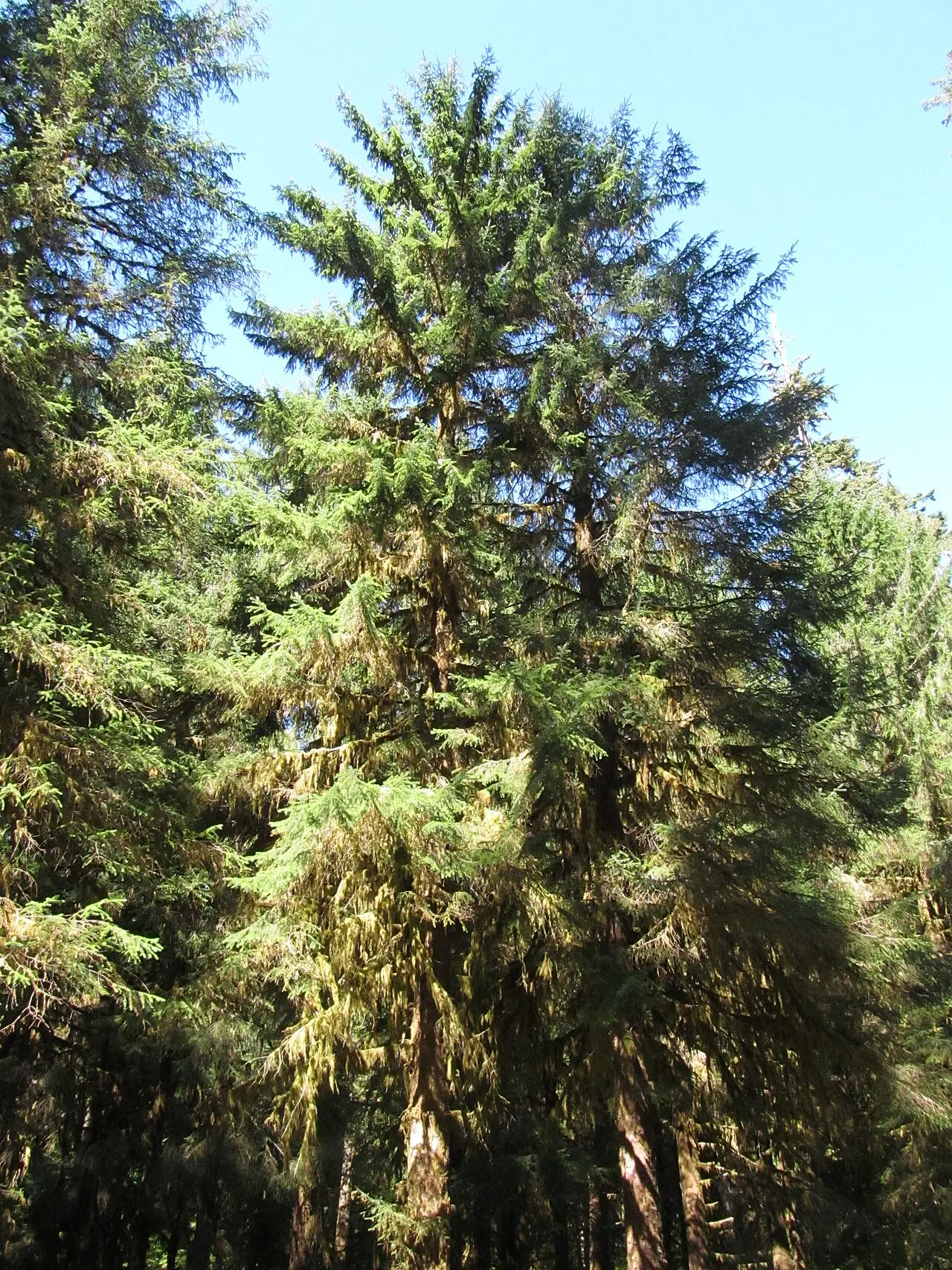
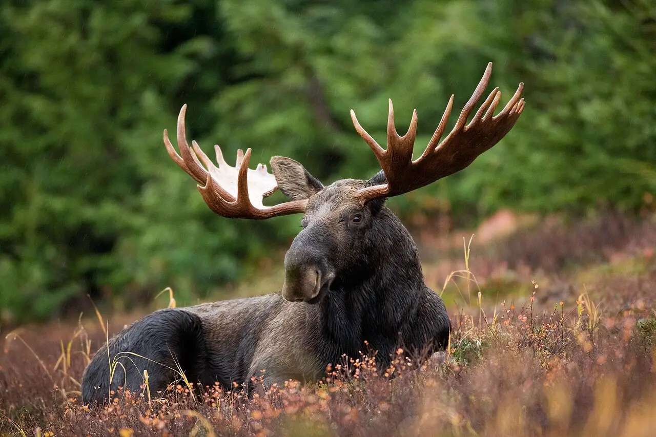
Most of Alaska’s 20 official symbols come straight from its landscape. The forget-me-not became the territorial flower in 1917, the willow ptarmigan, an Arctic grouse that turns white in winter, was picked by schoolchildren in 1955, and the Sitka spruce, king salmon, moose and bowhead whale followed. Dog mushing is the state sport, the Alaskan Malamute the state dog, and the woolly mammoth the state fossil. Schoolchildren chose the state insect too: the four-spot skimmer dragonfly, which beat the mosquito in a statewide vote.
Alaska also recognizes 23 Alaska Native languages as official languages alongside English, from Inupiaq in the far north to Tsimshian in the southeast. See every symbol, with the law behind it, on the Alaska symbols page.
Borders
Alaska borders no other state. It shares a long land border with Canada’s Yukon and British Columbia, and its coasts face the Pacific Ocean, the Bering Sea and the Arctic Ocean. At the Bering Strait, Alaska’s mainland lies about 55 miles from Russia.
Alaska state symbols
All 20 official symbols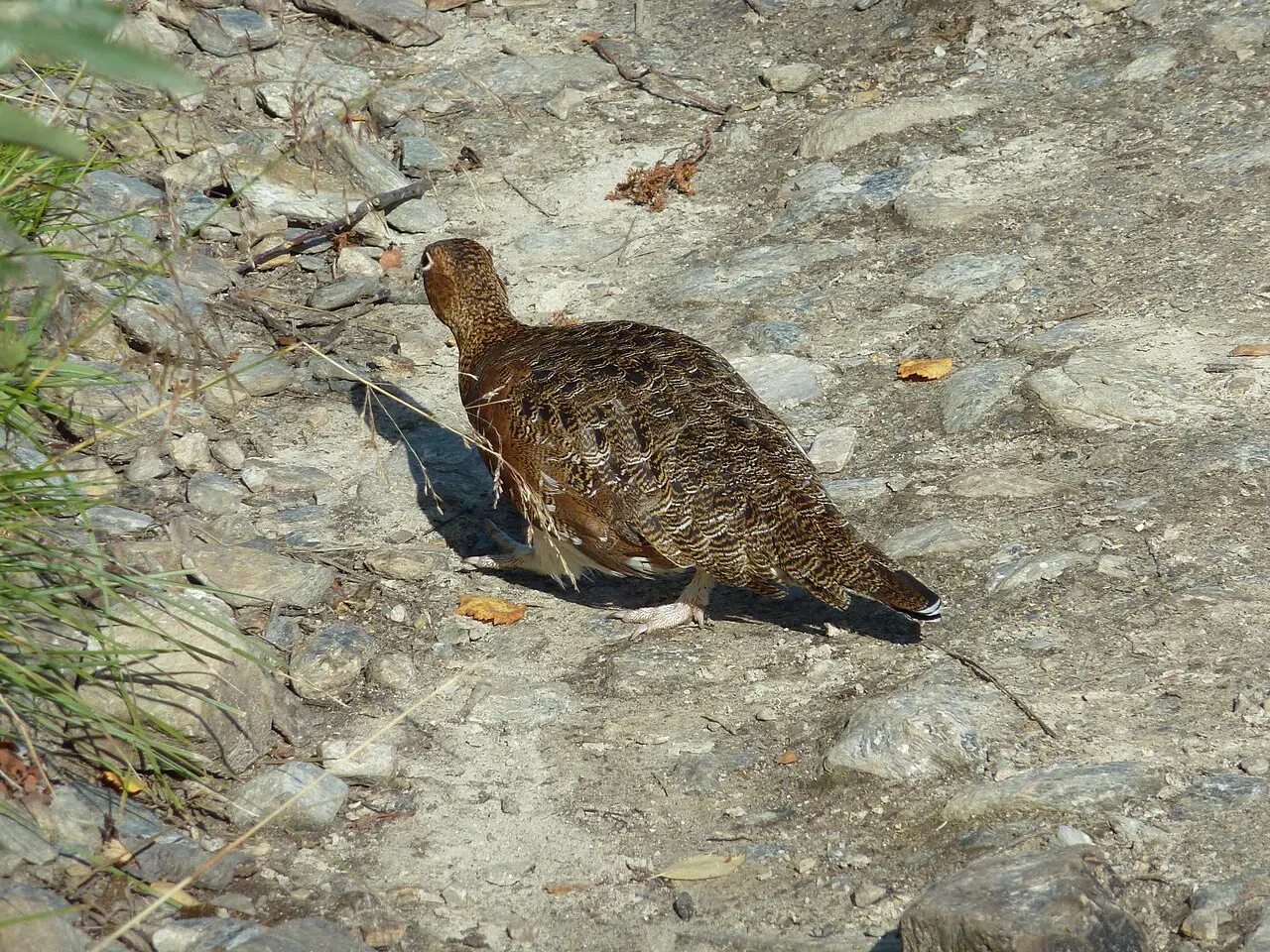
The capital: Juneau
The capital of Alaska is Juneau, the seat of government since 1906. Before that the capital was Sitka, which had also been the capital of Russian America. Juneau sits on the mainland in Southeast Alaska with no road connection to the rest of the continent, and Alaskans have voted more than once on moving the capital closer to Anchorage.
- 1906–todayJuneau
Where Alaska is
Alaska shares no land border with another state. It also borders Canada.
- Land area
- 570,641 sq mi
- Water area
- 94,743 sq mi
- Population density
- 1.3 people per sq mi (50th)
Alaska trivia
- Marie Drake's poem about the flag appeared in a school bulletin in October 1935; Elinor Dusenbury set it to music in 1938, saying she wrote it out of homesickness for Alaska.Source: University of Alaska
- Alaska's schoolchildren picked the state insect by ballot, and the four-spot skimmer dragonfly beat the mosquito by 879 votes.Source: University of Alaska Fairbanks Geophysical Institute
- When the capital moved from Sitka in 1906, the government's files, furniture and about 3,000 library books came to Juneau on the mail boat Georgia, landing September 8.Source: City and Borough of Juneau, Juneau-Douglas City Museum
- Alaska's official state rifle is restricted by law to Winchester Model 70s made before 1964, in 18 listed calibers.Source: Alaska State Legislature
Questions about Alaska
- What is the capital of Alaska?
- Juneau, the seat of government since 1906. Before that the capital was Sitka, which had also been the capital of Russian America.
- What is the largest city in Alaska?
- Anchorage, with about 287,000 people in 2025, roughly nine times the population of Juneau.
- How big is Alaska compared with Texas?
- Alaska covers 665,384 square miles, about two and a half times the area of Texas, the second-largest state.
- What does the name Alaska mean?
- It comes from the Unangan (Aleut) word for the Alaska Peninsula, Alaxsxa, meaning "the mainland." The popular translation "the Great Land" is a mistaken belief.
- What is Alaska's nickname?
- Alaska has no official nickname. The best known is "The Last Frontier," from the closing line of the state song; "Land of the Midnight Sun" is also common.
Photo credits (5)
- Flag of Alaska: Benny Benson, Public domain, via Wikimedia Commons
- Willow ptarmigan: Djiboun, CC BY-SA 4.0, via Wikimedia Commons
- Wild native forget-me-not: Sedum Tauno Erik, CC BY-SA 2.5, via Wikimedia Commons
- Sitka spruce: Doug Kerr from Albany, NY, United States, CC BY-SA 2.0, via Wikimedia Commons
- Moose: Ryan Hagerty, Public domain, via Wikimedia Commons
Sources
- Alaska Statehood (online documents) Dwight D. Eisenhower Presidential Library · statehood
- Digital Bob Archive: Juneau becomes the capital City and Borough of Juneau, Juneau-Douglas City Museum · capital
- Historic Structures Database: Federal and Territorial Building / Alaska State Capitol City and Borough of Juneau · capital
- The Story of a Name - Unalaska or Dutch Harbor? City of Unalaska
- Alaska Statutes AS 44.09 (state emblems) Alaska State Legislature
- Alaska Statutes AS 44.12.300-.399 (official languages) Alaska State Legislature
- Shoreline Mileage of the United States NOAA Office for Coastal Management
- Chilkat Ferry Terminal project history Alaska Department of Transportation and Public Facilities
- US Census Bureau Vintage 2025 population estimates; 2010 state area measurements