Indiana
The Hoosier State
Indiana became the 19th state on December 11, 1816. Its capital and largest city is Indianapolis, a planned city laid out in 1821 near the center of the state. Indiana is known as the Hoosier State, and its motto, adopted in 1937, is "The Crossroads of America."
- Capital
- IndianapolisCapital since 1825
- Statehood
- December 11, 181619th state
- Population, 2025
- 6,973,33317th of 50
- Area
- 36,420 sq mi38th largest · 94,326 km²
- Largest city
- Indianapolis901,116 people
- Abbreviation
- INUS Postal Service code
- Motto
- The Crossroads of AmericaEnglish
- Borders
- 4 statesLandlocked
The 19th state
Indiana began as part of the Northwest Territory. In 1800 Congress carved out the Indiana Territory, with its capital at Vincennes, an old French town on the Wabash River. The territorial government moved to Corydon, near the Ohio River, in 1813, and in June 1816 delegates met there to write a state constitution, by tradition sometimes working in the shade of a large elm because of the summer heat. On December 11, 1816, Indiana became the 19th state.
A name borrowed from Virginia
“Indiana” simply means “land of the Indians,” formed by adding a Latin-style ending to “Indian.” The name has an odd history. It was first used around 1768 for a tract of nearly 5,000 square miles in what is now West Virginia, which the Iroquois Six Nations granted to a Philadelphia trading company. When Virginia’s claim to the land won out, the name fell out of use, and in 1800 Congress reused it for the new territory west of Ohio.
Hoosiers
People from Indiana have been called Hoosiers since at least the 1830s, when John Finley’s 1833 poem “The Hoosier’s Nest” made the word popular. Nobody knows for certain where it came from. Theories range from a man named Hoosier who hired Indiana workers to the greeting “Who’s here?”, but the historian Jacob Piatt Dunn traced it to a word in English dialect for a hill dweller or a rough countryman. “The Hoosier State” is Indiana’s traditional nickname, though no law makes it official.
A capital in the middle
As settlers pushed north from the Ohio River, Corydon, in the far south, was no longer central. In 1820 a commission chose a site in the wilderness where Fall Creek meets the White River, near the middle of the state, and the General Assembly named it Indianapolis. The capital moved there on January 1, 1825. Corydon’s old capitol became the county courthouse and is now a state historic site. The capital page tells the story.
Crossroads of America
Indiana’s motto, “The Crossroads of America,” was adopted in 1937 and describes its place at the junction of major roads and railroads. The state song is “On the Banks of the Wabash, Far Away,” written in 1897 by Paul Dresser, the brother of novelist Theodore Dreiser, who spelled the family name differently.
Symbols
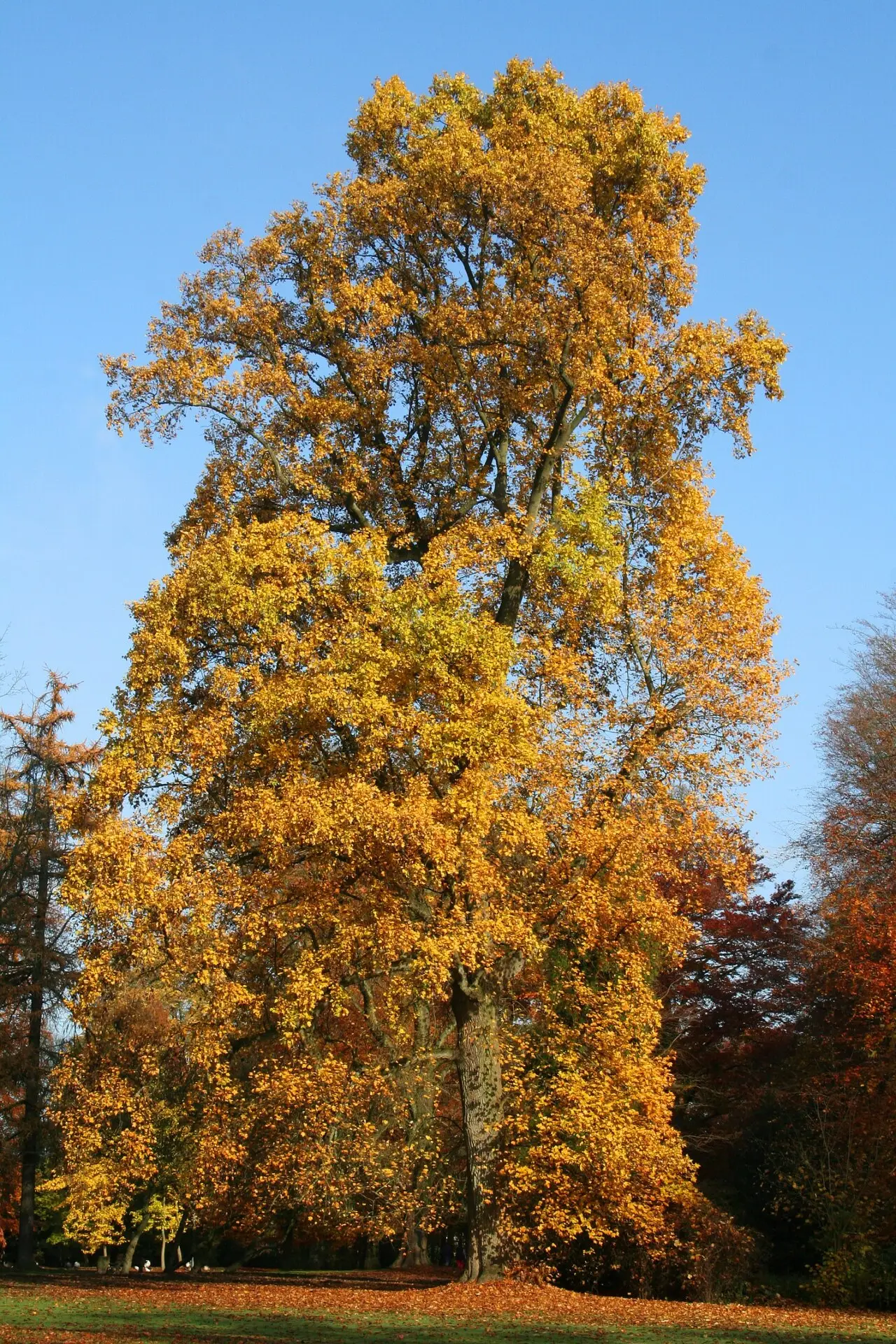
Indiana has 16 official symbols, a short list compared with many states. The cardinal has been the state bird since 1933, and the peony the state flower since 1957, replacing the zinnia. The tulip tree, one of the tallest hardwoods in the East, is the state tree, and its leaf appears in the border of the state seal. Salem limestone, the stone used for the Empire State Building and many other landmarks, is the state stone. Newer additions include Say’s firefly, proposed by a second grader, the P-47 Thunderbolt warplane, built in Evansville during World War II, and the mastodon, the state fossil since 2022. See every symbol on the Indiana symbols page.
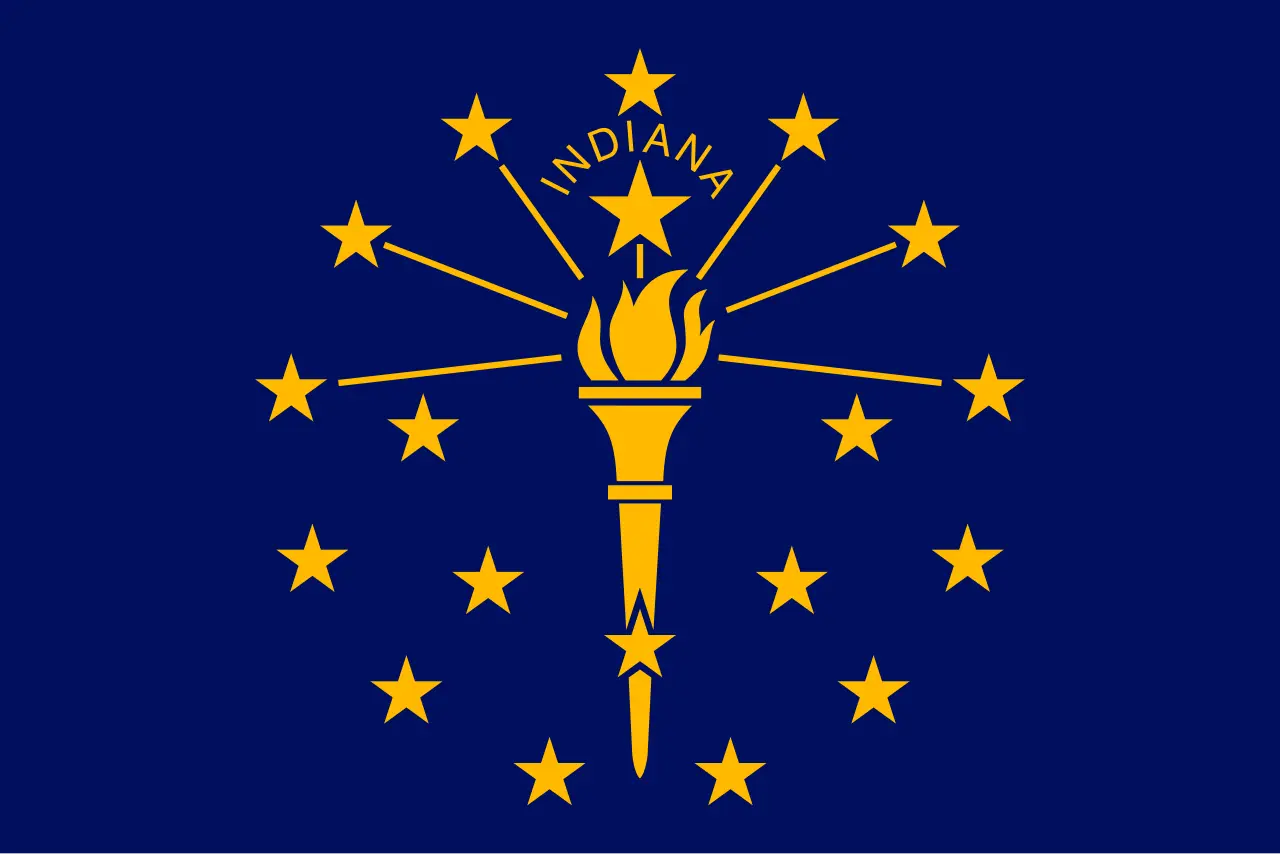
The flag shows a gold torch surrounded by 19 stars on a blue field; the largest star stands for Indiana as the 19th state.
Land and people
Indiana covers 36,420 square miles, 38th among the states, and had about 6.97 million residents in 2025, 17th in the country. It borders Michigan, Ohio, Kentucky and Illinois, touches Lake Michigan in the northwest, and follows the Ohio River along its southern edge. Indianapolis, with about 901,000 people, is the largest city by far, followed by Fort Wayne, Evansville and the fast-growing Indianapolis suburbs of Carmel and Fishers.
Indiana state symbols
All 16 official symbols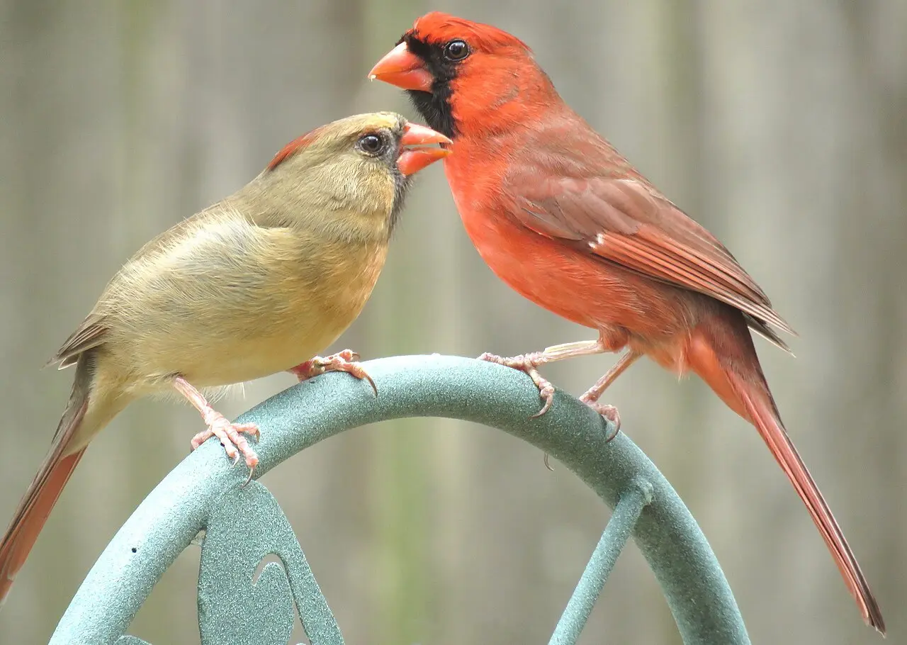

The capital: Indianapolis
The capital of Indiana is Indianapolis, the seat of government since January 1, 1825. It was a planned city, laid out in the wilderness near the center of the state after Indiana outgrew its first state capital, Corydon. Indianapolis is also Indiana's largest city, with about 901,000 people.
- 1813–1825Corydon
- 1825–todayIndianapolis
Where Indiana is
Indiana shares a border with 4 states: Illinois, Kentucky, Michigan and Ohio.
- Land area
- 35,826 sq mi
- Water area
- 593 sq mi
- Population density
- 194.6 people per sq mi (17th)
Indiana trivia
- The name Indiana was used first for a land company's tract in what is now West Virginia, and Congress reused it for the new territory in 1800 after that claim collapsed.Source: Indiana Historical Bureau
- Indiana law requires a different state flag to be flown over the Statehouse each day when practical, and legislators can ask for those flags to be sent to groups back home.Source: Justia (Indiana Code 2017)
- Nobody may legally reproduce or sell copies of Indiana's state rifle, the Grouseland Rifle, without permission from the Grouseland Foundation.Source: Justia (Indiana Code 2017)
- The state song's composer, Paul Dresser, was the brother of novelist Theodore Dreiser, and his surname is a different spelling of the family name.Source: Indiana Governor History (State of Indiana)
- After the government left for Indianapolis, Indiana's first capitol in Corydon became the Harrison County Courthouse, and it was used that way until 1929.Source: Indiana State Museum and Historic Sites
Questions about Indiana
- What is the capital of Indiana?
- Indianapolis. It became the capital on January 1, 1825, replacing Corydon.
- What is a Hoosier?
- A person from Indiana. The word was in general use by the 1830s, popularized by John Finley's 1833 poem "The Hoosier's Nest." Its origin is disputed; historian Jacob Piatt Dunn traced it to an English dialect word for a hill dweller.
- What does Indiana mean?
- "Land of the Indians." The name was first used around 1768 for a land company's tract in present-day West Virginia, and Congress reused it for the new Indiana Territory in 1800.
- What is Indiana's state motto?
- "The Crossroads of America," adopted by a resolution of the General Assembly in 1937.
Photo credits (4)
- Flag of Indiana: Paul Hadley (design, 1917); SVG by Zscout370 and HoosierMan1816, Public domain, via Wikimedia Commons
- Cardinal: patricia pierce, CC BY 2.0, via Wikimedia Commons
- Peony: MPF, CC BY-SA 3.0, via Wikimedia Commons
- Tulip tree: Jean-Pol GRANDMONT, CC BY 3.0, via Wikimedia Commons
Sources
- Corydon Capitol State Historic Site Indiana State Museum and Historic Sites · statehood
- The Statehouse Story Indiana Department of Administration, Statehouse Tour Office · capital
- Architectural Design Indiana Department of Administration, Statehouse Tour Office · capital
- The Naming of Indiana Indiana Historical Bureau
- What is a Hoosier? Indiana Historical Bureau
- Emblems and Symbols Indiana Historical Bureau
- US Census Bureau Vintage 2025 population estimates; 2010 state area measurements